Werthum Pass
Duration 14 days
Distance 52.5km
Start Passu
Finish Raminj

Mountain Guide
More Info
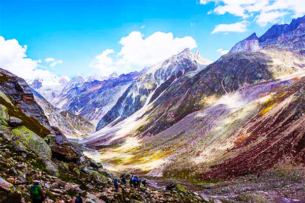
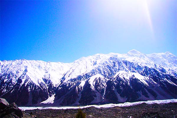
Werthum (‘millstone’ in Wakhi) is an infrequently crossed nonglaciated pass (5147m) linking the Batura Glacier to Chapursan’s Lupgar Valley to its north. The pass offers an alternative exit from the upper Batura Glacier, especially attractive for those climbing in the Werthum Valley. This rugged side valley north of the Batura Glacier has some easy nontechnical snowy peaks, and several technical peaks ranging from 5400m to 5900m at the valley’s head and along the Shireen Maidan (sweet field) Glacier. The views from the pass include the six Batura peaks and Shishpar. Crossing Werthum Pass isn’t technically difficult, but requires basic mountaineering skills.
PLANNING
What to Bring
What to Bring
A rope, ice axe and mountaineering equipment necessary to cut steps in the ice cornice on the north side of the pass are required (see Mountaineering Equipment,). Crampons aren’t necessary when crossing from south to north, but are when crossing from north to south. When trekking with porters bring a tarp or tent for their use because no huts exist for the two nights between Kukhil and Harkeesh.
Maps
Refer to Maps under the Batura Glacier trek (p). The Swiss map incorrectly marks the trail between Shireen and Maidan and Werthum Base Camp (unmarked), and misrepresents the confluence of the streams that form Werthum Nala. The actual trail is on the opposite side of the river from where the trail is drawn on the map; the map has it backwards. Unsuspecting trekkers have dangled on nasty scree slopes and cliffs trying to follow the trail depicted on the map. Werthum Pass isn’t marked and the glacier on its north side is much smaller than the map shows. Harkeesh isn’t marked either. It’s on the south side of the Lupgar River along the first side stream west (left) of the place name Purzin.
Maps
Refer to Maps under the Batura Glacier trek (p). The Swiss map incorrectly marks the trail between Shireen and Maidan and Werthum Base Camp (unmarked), and misrepresents the confluence of the streams that form Werthum Nala. The actual trail is on the opposite side of the river from where the trail is drawn on the map; the map has it backwards. Unsuspecting trekkers have dangled on nasty scree slopes and cliffs trying to follow the trail depicted on the map. Werthum Pass isn’t marked and the glacier on its north side is much smaller than the map shows. Harkeesh isn’t marked either. It’s on the south side of the Lupgar River along the first side stream west (left) of the place name Purzin.
| DAYS | ITINERARY | RESVERATION |
|---|---|---|
| Day1 | Islamabad Arrival & transfer to Hotel. | Hotel |
| Day2 | Drive to Chilas,10 - 12 hrs | Hotel |
| Day3 | Continue to Karimabad,6 - 7 hrs | Hotel |
| Day4 | Drive to Passu 2400M,1 - 2 hrs | Hotel |
| Day5 | Trek to Yunzben 2880M/ 5hrs | Camp |
| Day6 | Trek to Yashprit 3302M/ 3 - 5 hrs | Camp |
| Day7 | Trek to Shireen maidan 3 - 5 hrs | Camp |
| Day8 | Trek to werthum Base Camp 3 - 5 hrs | Camp |
| Day9 | Base Camp to High Camp 3 - 4 hrs | Camp |
| Day10 | Trek to Harkeesh 6 - 7 hrs | Camp |
| Days11 | Trek to Raminj & Drive to sost | Hotel |
| Days12 | Drive to Chilas 6 - 7 hrs | Hotel |
| Days13 | Drive to Islamabad 10 - 12 hrs | Hotel |
| Days14 | Transfer to Air port | - |